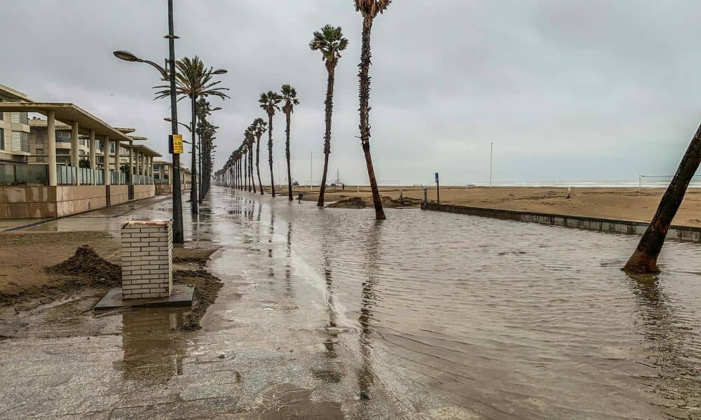
Last week, South Florida feeds lit up with jaw-dropping videos: cars half-submerged on Alton Road, seawater bubbling through storm drains, and joggers wading where sidewalks used to be. The cause wasn’t a storm or a water-main break—it was another round of king tides, the high-tide surges that turn parts of Miami into shallow canals each fall. If your street looked like that, it’s time to take a closer look at your elevation certificate. This document reveals how high—or how low—your property sits compared to expected flood levels. In coastal zones like Miami, it’s becoming the first line of defense against recurring floods.
Why the Water Keeps Coming Back
King tides happen every year when the sun and moon align to pull ocean water a little higher than usual. Combine that with gradual sea-level rise, and you get saltwater flooding even on sunny days.
Neighborhoods such as Brickell, Edgewater, and Miami Beach experience it first. Pumps hum, seawalls strain, and drivers inch through brackish water hoping their engines don’t stall. The problem isn’t just bad luck—it’s elevation. Some blocks stand barely three feet above sea level. When the tides push inland, gravity takes over, and the lowest ground loses.
What an Elevation Certificate Really Tells You
An elevation certificate (often called an EC) is your property’s scorecard for flood readiness. It measures your building’s height against FEMA’s Base Flood Elevation (BFE)—the line predicting how high flood waters could rise during a major event.
Two other details matter just as much:
- C2.a: the top of your lowest finished floor
- LAG: the lowest adjacent grade, or the lowest ground beside your structure
Together, they show whether water would reach your living space during a flood. An outdated or missing EC can give you a false sense of safety.
When Old Numbers Tell the Wrong Story
Many older elevation certificates still reference NGVD 29, an outdated vertical system. Surveyors now use NAVD 88, which reflects current sea-level data. The difference can reach a foot—enough to turn “safe” into “soaked.”
If your certificate lists NGVD 29 or predates 2010, don’t rely on it. A licensed surveyor can update your EC using the correct datum and confirm whether your property remains above today’s flood benchmark.
Why a Fresh Survey Matters After Each King Tide

The first week of October’s king tide was a preview of what’s expected later this month. Even a few inches of standing water around your home means the tides are creeping closer.
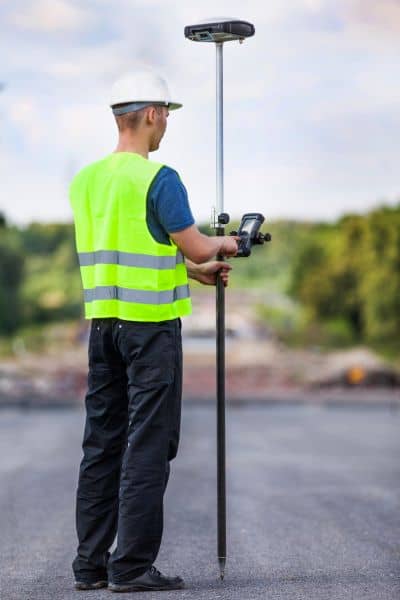
You don’t always need a full boundary survey. A quick spot-topo—a few targeted elevation shots on your slab, driveway, and yard—can update your record accurately. That small update keeps your elevation certificate useful for insurance, remodeling, or future flood-mitigation plans.
Miami’s Uneven Ground: Inches Make the Difference
Miami looks flat from above, but it isn’t. Elevation can change several inches between blocks. That’s why one house floods while another across the street stays dry.
Surveyors depend on the Miami-Dade County Survey Control Network and NOAA tidal benchmarks to capture exact elevations. These reference points tie every measurement to FEMA’s official maps. Without them, a certificate might meet paperwork standards but fail to show true risk on the ground.
Beyond Insurance Forms
Yes, FEMA and the National Flood Insurance Program often require an elevation certificate, but its value reaches further.
Developers use ECs to prove new structures meet floodplain codes. Homeowners use them to plan drainage improvements or install flood barriers. Buyers rely on them to compare properties before signing. In short, the EC turns vague flood chatter into hard numbers you can act on.
Learning from This Week’s Floods
The October 2025 king tide wasn’t a random event—it was a reminder. Sea levels keep rising, and the same streets will flood again when the next full moon aligns.
If your driveway or yard went underwater, pull out your elevation certificate. Check the issue date, verify that it lists NAVD 88, and make sure the photos and address match your home’s current layout. If anything looks off, contact a licensed land surveyor. Updating your EC now is faster—and cheaper—than repairing after the next tide.
Steps to Stay One Tide Ahead
- Review your elevation certificate before the next high-tide window (mid-October through November).
- Note any pooling or backflow after this week’s floods—those clues guide surveyors to re-measure critical spots.
- Schedule a quick check-up. A same-week field visit can confirm slab and yard elevations and keep your EC current.
- Share your data with insurers, engineers, or contractors planning mitigation work.
Each action builds a clearer picture of your property’s true flood resilience.
The Bottom Line
The ocean isn’t waiting for a hurricane to test Miami’s defenses. It’s already arriving—quietly, predictably, and higher every year.
Your elevation certificate isn’t just another form for closing paperwork; it’s your map of safety. It tells you, in inches and feet, how close the tide really is.
So before the next king tide peaks later this month, don’t just watch more viral clips of flooded streets. Check your own numbers, talk to a surveyor, and make sure your data reflects today’s reality. Because when the streets become canals, the homeowners who know their elevation are the ones who stay dry.


