Why You SHOULD Have a Land Survey Completed Before Purchasing Land?

Buying land, whether commercial or residential, is always an expensive endeavor, even if prices have eased somewhat lately. This is why finding a piece of land that you like and making an offer for it without conducting a land survey on the area is possibly the biggest mistake that you can make.

Here’s why it’s very important that you have land surveying done first:

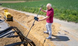
Land surveyors can determine if you’re actually getting what you’re going to pay for. This means find out whether the sidewalks, trees, driveways and even the bird bath is part of the property you’re about to buy. Land surveying would also determine whether the neighbors are encroaching into the property, which would then mean you’re going to have problems in the future with your neighbors.
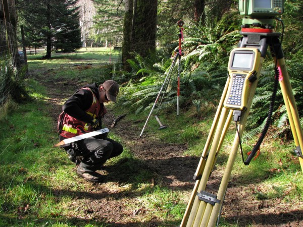
Land SurveyHiring a lamand surveyor doesn’t only mean they determine what you’re getting or not getting – land surveyors are the experts, and they can help with building regulations, wetland regulations, etc. Take note that these regulations can change anytime, but land surveyors should be updated on these regulations, or they will refer you to someone who is.

What if the current landowner (the one selling the land) can provide you with old land survey documents? You should still hire your own land surveyor to see if the boundary monuments are still in place. Also, land surveying done a few years back may not show recent changes to the land. If the existing survey is older than about ten years, you should get a whole new survey. Technology and surveying standards are both a lot better now and should provide you more confidence in the survey work.

Second, that survey was completed for that owner. He may have instructed the surveyor not to show certain things on the drawing. At least have a land surveyor go out and review the parcel with this survey in hand. We have seen numerous cases where a new land survey would save the buyer thousands so don’t become a victim.

I’ve heard a lot of people say hiring a land surveyor is nothing but unnecessary expense. I’ll tell you what’s unnecessary: the stress caused by paying thousands of dollars for something and ending up not getting what you were expecting. If you are smart, you’d hire a certified land surveyor before making any land purchases.
author avatar
Surveyor

More Posts

Drone land surveying over a construction site capturing aerial data for mapping and site planning
land surveying
Surveyor

FAA Part 108: What It Means for Drone Land Surveying

Drone land surveying has already changed the way projects get built in Tampa. From construction staking to floodplain mapping, surveyors use drones every day to capture fast and accurate data. Now, the FAA has introduced a new proposal—Part 108—that could reshape how surveyors fly drones, how close they can get

Read More »
Surveyor using total station to measure property survey data near residential homes in a flood zone
boundary surveying
Surveyor

Property Survey Steps to Challenge Your Flood Zone

If you live in Fort Myers, you probably know how expensive flood insurance can be. What many homeowners don’t realize is that their property might not even belong in the flood zone FEMA has mapped. That’s where a property survey comes in. It’s the first and most important step in

Read More »
A car driving through a flooded street with water splashing on both sides, surrounded by green trees and road signs, highlighting the importance of flood elevation surveys for assessing flood risks in residential areas.
flood damage
Surveyor

Homeowners Rush to Get Flood Elevation Surveys

After Hurricane Idalia hit Jacksonville, many homeowners are seeing that Flood Elevation Surveys are more important than ever. These surveys show how high a home sits compared to the surrounding flood areas. In today’s conditions, this information can save time and money on insurance claims. Licensed surveyors are very busy,

Read More »
Aerial drone view of Pensacola Beach shoreline showing waves and coastal erosion highlighting the need for a property survey
boundary surveying
Surveyor

Do You Need a Property Survey After Coastal Erosion?

When people think about coastal erosion, they picture crashing waves, washed-out dunes, and worried lifeguards waving red flags. That’s exactly what Pensacola Beach saw this past Labor Day weekend. Rough surf and rip currents made headlines as crowds still filled the sand despite warnings. But here’s the part many homeowners

Read More »
Cars driving through flooded streets in downtown Miami during King Tide, showing the need for an ALTA survey to document property elevations
alta survey
Surveyor

Why an ALTA Survey Matters Before King Tide Flooding

If you live or own property, you already know how tricky flooding can be. Every year, the city braces for the King Tide season, when higher-than-normal tides push seawater onto streets and yards. These tides are more than just a nuisance; they can cause damage, complicate insurance claims, and delay

Read More »
Aerial view of a Jacksonville neighborhood with topographic survey contour lines and elevation mapping using drone and LiDAR technology
land surveying
Surveyor

How Topographic Surveys Are Changing Land Projects

Topographic surveys help builders and engineers understand the shape and height of the land before they start work. Whether it’s for new homes, roads, or parks, knowing the land’s details is very important. Thanks to new technology like drones and special scanners, these surveys are faster and more accurate than

Read More »