How to Find Someone to Survey Your Property Boundary Correctly

There are different reasons why somebody would need boundary surveying in their property. Often, this type of surveying is done if the owner of the property wants to legally place an item on the property such as a new structure or a fence.

A Licensed Land Surveyor

When hiring a land surveyor, you have to make sure that he is duly licensed by your state. A “licensed” land surveyor means he was able to complete his studies, passed all exams and is certified to perform specific types of land surveys.

Hiring a licensed land surveyor is especially important if there is a dispute over a certain area of a property as the court would be asking for the current boundary survey result as well as testimony from a licensed land surveyor. With this being said, you also have to make sure that the surveyor you’re going to hire can also stand as an expert witness in court.

Looking for a Licensed Land Surveyor
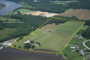
If your property has been surveyed before, it would be easier for you to contact that land surveyor again. This is the best option for several reasons; he already has all information about your property, making it easier for him to perform a new type of survey.

You can typically find your land surveyor’s information on the survey result given to you (if you’ve bought the property from somebody, for instance) or the result given to you by the surveyor himself.

If you don’t have the survey drawing, you can also check the markers put in place by the surveyor during the last survey done on your property. These markers, which looks like iron pegs or pipes, should have the surveyor’s license number/ name on it. You can use this information to find the surveyor online.

If you can’t find the surveyor who worked on your property before, or if the property has never been surveyed, you should easily find a land surveyor in your area (for a land surveyor in the Florida area, click here).

Important Points to Remember when Hiring an ALTA Surveyor

  • As mentioned, make sure that he or she is a licensed land surveyor.
  • He or she should have experience in performing alta boundary surveys. If you’re going to pay somebody, you’d rather have someone who has done it before, right?
  • Look for someone easy to talk to. Communication is very important when hiring a land surveyor. You see, surveying is more of an art than a science – this is why land surveying results vary. It’s important that your surveyor understand why you’re having the survey, what you’re going to use the results for and how soon you’ll be needing the results.
author avatar
Surveyor

More Posts

Surveyors measure a home’s elevation to help update the flood elevation certificate used for insurance
flood damage
Surveyor

Stop Insurance Hikes With Your Flood Elevation Certificate

If you live in Pensacola, you’ve probably heard neighbors complain about sudden insurance increases. Some saw rates jump without warning, while others learned their home was moved into a new flood zone. These surprises often come from one simple issue: homeowners don’t use their flood elevation certificate to check what

Read More »
Drone performing aerial surveying along a coastal area to map flood risk
land surveying
Surveyor

When Flood Insurance Stopped, Aerial Surveying Stepped In

When the federal flood insurance program (NFIP) suddenly stopped earlier this month, many property closings across Florida froze overnight. In coastal cities like Fort Myers, lenders wouldn’t move forward without new flood information. Builders worried their projects might get delayed for weeks—or even canceled. That’s when aerial surveying became the

Read More »
Utility workers digging near a residential yard to show how a due diligence survey reveals easements and prevents surprises
boundary surveying
Surveyor

City Put a Sign on Your Yard? Get a Due Diligence Survey

If you’ve ever woken up to find a big sign or utility box planted on your front lawn, you’re not alone. A recent viral post on r/Jacksonville started with one frustrated homeowner saying, “The city put a giant sign on my yard without warning.” The comment section filled up fast—with

Read More »
Aerial view of a flooded residential neighborhood highlighting how a boundary survey can define property limits and prevent drainage problems
boundary surveying
Surveyor

Flood Prevention Starts With a Boundary Survey

When heavy rain hit Central Florida last week, few expected a calm neighborhood near Cocoa—just east of Orlando—to end up underwater. More than a hundred homes flooded overnight after a retention pond overflowed. Families scrambled to move their cars and belongings as muddy water crept through driveways and doorsteps. Officials

Read More »
Stormwater design shown through a curb inlet with sandbags and surface runoff on a residential street during rain preparedness.
civil engineering
Surveyor

Is Your Stormwater Design Ready for the Next Big Rain?

Stormwater design might sound like a background detail until the sky opens up over Pensacola. This week, the National Weather Service in Mobile is warning about heavier rain, coastal flooding, and hazardous surf across Escambia County. The City of Pensacola has also been posting updates about ongoing drainage and stormwater

Read More »
Flooded coastal streets showing rising water along a beachfront walkway.
flood damage
Surveyor

When Streets Flood: Check Your Elevation Certificate

Last week, South Florida feeds lit up with jaw-dropping videos: cars half-submerged on Alton Road, seawater bubbling through storm drains, and joggers wading where sidewalks used to be. The cause wasn’t a storm or a water-main break—it was another round of king tides, the high-tide surges that turn parts of

Read More »