ALTA Survey Table A Items: What to Include

Buying a commercial property in Miramar feels straightforward at first. You review the deal, check the numbers, and move toward closing. Then the survey comes up, and things get unclear fast. Most buyers don’t realize how much can be missed at this stage. You hear “ALTA survey,” and that part sounds familiar. But then someone […]
Why Homebuyers Need a Residential Surveyor Before Closing

Buying a home in Pembroke Pines feels fast right now. Homes don’t sit long. Buyers make quick decisions. Many people rush to secure a deal before someone else steps in. That pressure changes how people buy. It also leads to skipped steps. One of those steps is working with a residential surveyor. At first, it […]
Why Property Surveys Get Rejected And How to Fix It
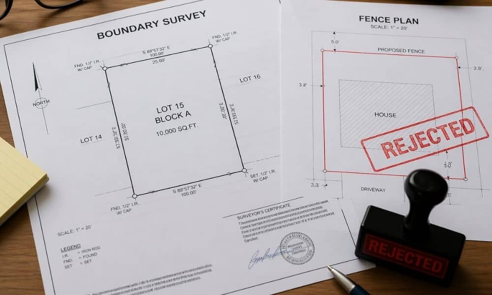
You send in your fence permit. Everything looks fine. Then the city sends it back. Rejected. Most people think the fence design caused the problem. That’s usually not the case. A lot of the time, the issue comes from the paperwork you submitted, especially the property surveys attached to the application that don’t quite match […]