land surveying
Why Ethical Backlash Is Changing How LiDAR Mapping Is Used
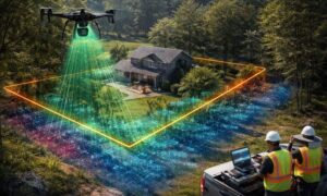
LiDAR mapping has become a trusted way to understand land. It helps professionals see details that are hard to spot from the ground. Over the
LiDAR mapping has become a trusted way to understand land. It helps professionals see details that are hard to spot from the ground. Over the
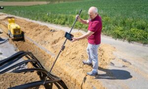
When news broke about a trench rescue at a construction site in Safety Harbor, many people in the construction world stopped and paid attention. A
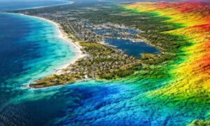
Florida is paying more attention to its coastline. Flooding, growth, and older roads and utilities are pushing the state to improve how it maps land