Why LiDAR Mapping Looks Accurate but Has Elevation Issues
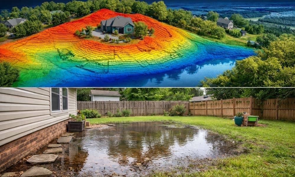
You get your lidar mapping results, and everything looks sharp. The lines are clean. The details are clear. At first, it feels like you have the perfect picture of your land—just like you would expect when reviewing your property survey results. However, weeks later, something feels off. Water starts pooling in the wrong spot. A […]
Why ALTA Surveys Matter in Commercial Transactions
When it comes to buying or refinancing commercial property in Florida, one of the most important steps in due diligence is ordering an ALTA survey. This detailed land survey, guided by national standards, plays a key role in identifying risks and ensuring all parties understand exactly what’s being purchased. Whether you’re dealing with beachfront real […]
A Short History on Land Surveying
Land surveying is one of the the oldest professions anywhere. When a parcel line separates two owners – land surveying is needed.