When the federal flood insurance program (NFIP) suddenly stopped earlier this month, many property closings across Florida froze overnight. In coastal cities like Fort Myers, lenders wouldn’t move forward without new flood information. Builders worried their projects might get delayed for weeks—or even canceled. That’s when aerial surveying became the unexpected hero.
A Flood of Problems on the Coast
In Fort Myers, where new buildings are often close to the water, flood zones are always a big concern. Builders, buyers, and lenders need accurate elevation data to prove that a property sits high enough above the Base Flood Elevation (BFE). Without it, banks hold back loans, insurance costs rise, and deals fall apart.
When the NFIP paused, the problems started quickly. Government flood maps were out of date. FEMA couldn’t process new Elevation Certificates (ECs) or Letters of Map Amendment (LOMAs). Regular survey crews were already booked. One developer working near San Carlos Bay needed fast proof that their land was safe to build on.
They needed data—and they needed it now.
The Drone Surveyor Steps In
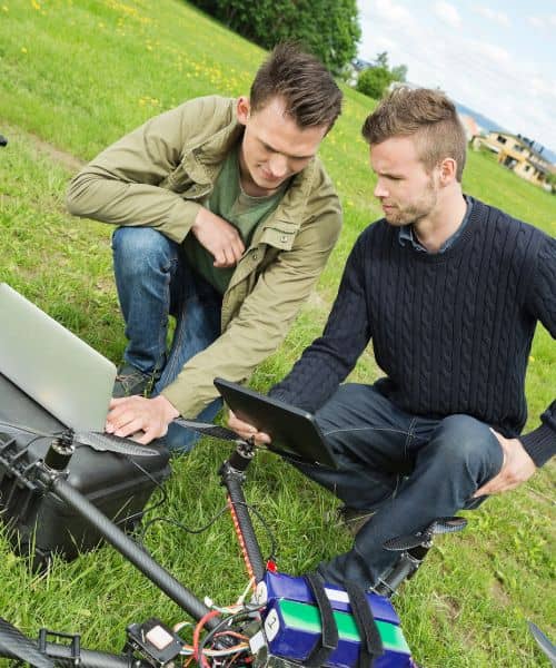
Instead of waiting weeks for a crew on the ground, the developer called a licensed drone surveyor. Within a day, a drone with LiDAR and camera sensors flew over the site, capturing thousands of precise data points.
By the next morning, the surveyor delivered a 3D elevation map accurate within a few centimeters. The data showed that most of the site was above the FEMA flood zone—something older maps had missed.
That report changed everything. The lender accepted it, private flood coverage was arranged, and the project moved forward. What could have been a costly delay turned into a quick success.
Why Aerial Surveying Works
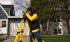
Surveying used to depend only on ground tools—tripods, GPS poles, and total stations. Those tools still matter, but in coastal Florida, getting around isn’t always easy. Mud, mangroves, and standing water slow things down.
Aerial surveying collects accurate measurements from the sky. It covers large or hard-to-reach areas quickly and safely. With high-resolution images, surveyors can create detailed elevation maps and drainage models without walking every foot of the property.
In Fort Myers, this has become essential. After just one big storm, a shoreline can shift. Aerial maps help builders spot changes, plan better drainage, and keep projects on schedule.
Speed That Saves Projects
One of the best parts of aerial surveying is how fast it works. Traditional surveys can take several days or even weeks. Drones can often finish in a few hours.
During the NFIP pause, that speed was a lifesaver. Many buyers and builders were stuck waiting for flood data. Drone surveys gave them the proof they needed to use private flood insurance and keep their closings on track.
The same speed helps outside emergencies too. Developers now use drone surveys early in design to check slopes, drainage, and grading. Homeowners use them to confirm their home’s elevation before buying or remodeling near the coast.
What It Means for Fort Myers and Lee County
In Lee County, flood safety is a big deal. The county updates its maps often, and new flood zones are coming in 2026. That means a property that’s safe today could be labeled risky later.
Homeowners can look up Elevation Certificates online at the Lee County website. If one doesn’t exist—or is out of date—an aerial survey can provide quick, updated data. Surveyors can even use the information to help file a LOMA, which might lower flood insurance costs if a house sits higher than the official map shows.
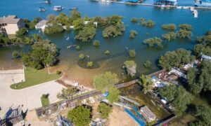
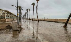
This is especially important during king tide season. Earlier this month, Fort Myers saw the year’s highest tides, and water reached some driveways and yards. Up-to-date elevation data helps prove a property’s safety when insurers or lenders have questions.
More Than Just Flood Maps
Aerial surveying isn’t only for flood work. Construction crews use it to track grading, check elevations, and make sure walls or foundations match design plans. Real estate agents use aerial images to market big lots and waterfront homes. Environmental teams rely on drones to monitor wetlands and shoreline changes.
Because drones collect so much data, surveyors can fly again months later and compare the results. That helps catch erosion or drainage problems before they turn into expensive repairs.
In short, aerial surveying gives you a real-time story of how your land is changing.
Why It Matters Now
The NFIP pause showed how fast things can go wrong when paperwork and old data slow people down. But technology offers a way forward. In Fort Myers, where water is part of everyday life, having current, accurate elevation data is not optional—it’s smart protection.
Whether you’re building a subdivision, buying a coastal lot, or refinancing your home, aerial surveying gives you the information you need to make confident decisions.
The Bottom Line
A few years ago, drone surveying sounded like the future. Now it’s a must-have tool for builders and surveyors. The mix of accuracy, speed, and safety is changing how land work gets done.
When flood insurance stops, when maps don’t match reality, or when lenders hesitate, a drone survey can turn weeks of waiting into quick results.
Aerial surveying isn’t just changing the game—it’s helping Fort Myers keep building smarter, safer, and higher.

