Welcome to ALTA Survey Florida

Your Final Stop for Your ALTA Survey Needs!                              Contact us today for a free quote!

This site is intended to provide you with information on ALTA Surveying in Florida. If you’re looking for a Florida Land Surveyor, you’ve come to the right place. If you’d rather talk to someone about your land surveying needs, please call our toll-free number at (888) 808-9783 today. For more information, please continue to read.

ALTA Survey Florida

Land Surveyors are professionals who make precise measurements to determine the size and boundaries of a piece of real estate.  While this is a simplistic definition, boundary surveying is one of the most common types of surveying related to home and land owners. If you fall into the following categories, please click on the appropriate link for more information on that subject:

ALTA Survey Florida services:

    1. I need to know where my property corners or property lines are. (Boundary Survey)
    2. I have a loan closing or re-finance coming up on my commercial property. (ALTA Survey)
    3. I need a map of my property with contour lines to show elevation differences for my architect or engineer. (Topo Survey – ALTA Survey plus Table A Item 5.)
    4. I’ve just been told I’m in a flood zone or I’ve been told I need an elevation certificate in order to obtain flood insurance or prove I don’t need it. (Flood Survey)
    5. I’m purchasing a lot/property for a commercial use. (ALTA Survey – Item 5 and/or Item 11b may also need to be discussed.)
    6. I’m purchasing a larger tract of land, acreage, that hasn’t been subdivided in the past. (Boundary Survey)
author avatar
Surveyor

More Posts

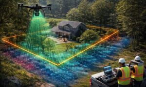
Drone land surveying over a construction site capturing aerial data for mapping and site planning
land surveying
Surveyor

FAA Part 108: What It Means for Drone Land Surveying

Drone land surveying has already changed the way projects get built in Tampa. From construction staking to floodplain mapping, surveyors use drones every day to capture fast and accurate data. Now, the FAA has introduced a new proposal—Part 108—that could reshape how surveyors fly drones, how close they can get

Read More »
Surveyor using total station to measure property survey data near residential homes in a flood zone
boundary surveying
Surveyor

Property Survey Steps to Challenge Your Flood Zone

If you live in Fort Myers, you probably know how expensive flood insurance can be. What many homeowners don’t realize is that their property might not even belong in the flood zone FEMA has mapped. That’s where a property survey comes in. It’s the first and most important step in

Read More »
A car driving through a flooded street with water splashing on both sides, surrounded by green trees and road signs, highlighting the importance of flood elevation surveys for assessing flood risks in residential areas.
flood damage
Surveyor

Homeowners Rush to Get Flood Elevation Surveys

After Hurricane Idalia hit Jacksonville, many homeowners are seeing that Flood Elevation Surveys are more important than ever. These surveys show how high a home sits compared to the surrounding flood areas. In today’s conditions, this information can save time and money on insurance claims. Licensed surveyors are very busy,

Read More »
Aerial drone view of Pensacola Beach shoreline showing waves and coastal erosion highlighting the need for a property survey
boundary surveying
Surveyor

Do You Need a Property Survey After Coastal Erosion?

When people think about coastal erosion, they picture crashing waves, washed-out dunes, and worried lifeguards waving red flags. That’s exactly what Pensacola Beach saw this past Labor Day weekend. Rough surf and rip currents made headlines as crowds still filled the sand despite warnings. But here’s the part many homeowners

Read More »
Cars driving through flooded streets in downtown Miami during King Tide, showing the need for an ALTA survey to document property elevations
alta survey
Surveyor

Why an ALTA Survey Matters Before King Tide Flooding

If you live or own property, you already know how tricky flooding can be. Every year, the city braces for the King Tide season, when higher-than-normal tides push seawater onto streets and yards. These tides are more than just a nuisance; they can cause damage, complicate insurance claims, and delay

Read More »
Aerial view of a Jacksonville neighborhood with topographic survey contour lines and elevation mapping using drone and LiDAR technology
land surveying
Surveyor

How Topographic Surveys Are Changing Land Projects

Topographic surveys help builders and engineers understand the shape and height of the land before they start work. Whether it’s for new homes, roads, or parks, knowing the land’s details is very important. Thanks to new technology like drones and special scanners, these surveys are faster and more accurate than

Read More »