Stormwater design might sound like a background detail until the sky opens up over Pensacola. This week, the National Weather Service in Mobile is warning about heavier rain, coastal flooding, and hazardous surf across Escambia County. The City of Pensacola has also been posting updates about ongoing drainage and stormwater upgrades—proof that the city is getting ready. But the question is, is your own stormwater design ready too?
When rain falls hard and fast, your site’s systems face a live test. The coming weather isn’t just another downpour—it’s a chance to see if your curbs, pipes, and ponds can actually handle what they were built for. If your system fails, you’ll see the evidence right away: standing water, backed-up drains, or flooding near entrances.
Why Rain Events Are the Real Stress Test
Pensacola’s charm comes with a challenge: flat ground, sandy soil, and a high water table. It doesn’t take much rain to overwhelm an unprepared site. Even one inch per hour can turn a parking lot into a shallow pool. Engineers call this a “design storm”—a specific rainfall event that your drainage system should handle without flooding.
When your stormwater design falls short, it’s usually because of one of three issues: clogged structures, poor grading, or outdated capacity. That means the system can’t move water fast enough, so it backs up onto the surface. Unfortunately, by the time you notice, it’s already too late to fix it at the moment. That’s why paying attention before and during this weekend’s rain can give you priceless data about how your property performs.
1. The Story Starts at the Grate
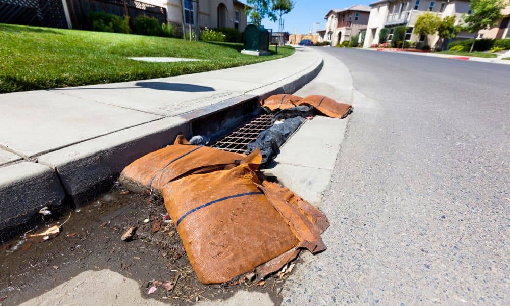
Walk around your property before the rain begins. The first things to check are your curb inlets and storm grates. If they’re covered with leaves, mulch, or trash, water will have nowhere to go. Most flooding around parking areas or driveways happens because of this simple issue. A quick five-minute clean-up can prevent a two-day problem.
During the storm, watch how quickly water drains once the rain slows down. If puddles linger for more than half an hour, it may mean the grate is undersized or the pipe is partially blocked. Engineers often find sediment buildup just a few feet inside the pipe that you can’t see from the surface.
2. The Hidden Player: Detention Ponds

Many properties have detention or retention ponds tucked behind buildings or near lot corners. These basins store runoff temporarily so it doesn’t overwhelm the city system. After a heavy rain, the water should slowly drop back to normal within 24 to 48 hours. If it’s staying full or draining too fast, something’s off in your stormwater design.
A pond that drains too slowly can signal a blocked outlet or poor soil infiltration. One that drains instantly might mean erosion or a damaged outflow pipe. Both problems point back to how your stormwater system was designed—or maintained. Watching your pond during and after the storm helps identify issues early, before they become expensive repairs.
3. The Flow Path Tells the Truth
Grab an umbrella and look where the water actually goes. Many site plans assume runoff flows neatly toward inlets, but in real life, grading settles, asphalt shifts, and new landscaping changes slopes. You might see water flowing in the opposite direction of your design plan. These small diversions cause ponding at building corners or low-lying sidewalks.
That’s why every major rain is an opportunity to map reality. Take quick phone videos of flow paths and low spots. Civil engineers use this data to update grading plans and improve stormwater performance. It’s real-world feedback, not just numbers on a screen.
4. The Parking Lot: Ground Zero for Drainage Issues
Pensacola’s retail and residential parking areas take a beating during storms. Water pools where pavements dip or where drains have sunk slightly over time. These issues may look cosmetic, but they hint at larger drainage flaws underneath. Standing water not only ruins asphalt but also creates slip hazards and increases liability.
If you manage a property, track which parking stalls flood first. That information helps engineers redesign flow lines or add extra catch basins. Good stormwater design isn’t just about keeping basements dry—it’s about keeping your daily spaces functional after every rain.
5. When the Roof Joins the River
Roof runoff plays a huge role in site drainage. If downspouts or scuppers release water onto walkways or landscaped areas, it can quickly erode soil or overload nearby inlets. During the rain, check whether roof leaders discharge directly to the storm system or spill onto pavement. Rerouting even one pipe can prevent hundreds of gallons from flooding your entrance.
Smart stormwater design connects roof drainage into a managed system, balancing flow between ground surfaces and pipes. If your site doesn’t have that setup, this weekend’s rain will make it obvious.
6. Maintenance Logs: Your Secret Insurance
While most people look at puddles, engineers look at paperwork. Pensacola participates in the MS4 (Municipal Separate Storm Sewer System) program, which means private sites must keep records of drainage maintenance. After the storm, take photos of every inlet, pond, and flow path you inspected. Label them by date and store them in a shared folder. Over time, this becomes a valuable maintenance log that can save you trouble during city inspections—or help you prove compliance if flooding ever causes property damage.
Turning Data Into Design Improvements
Every storm teaches something. If your site floods this weekend, that doesn’t mean your engineer failed. It means the site gave you feedback. Maybe the soil drains slower than expected. Maybe traffic areas settled over time. Maybe vegetation blocked the swale. Engineers use this data to recalibrate design models—changing slope angles, pipe sizes, or detention volumes for the next project.
That’s why a good civil engineering firm sees every rain event as a real-world lab. Instead of waiting for the next problem, they gather data, adjust plans, and build resilience into every new design. That’s what separates a compliant system from a future-proof one.
Final Thoughts:
This weekend’s rain could be the clearest signal you’ll get all year. Take a walk outside. Watch where the water goes. Record what you see. Then call your civil engineer to review your stormwater design before the next storm season begins.
Because in Pensacola, every drop is a test—and the sooner you learn from it, the safer your property will be.


