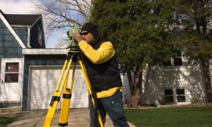
Renovations are exciting. Whether you’re adding a new room to your Fort Myers home, building a backyard deck for entertaining, or upgrading your driveway to handle the Florida rains, it feels good to improve your space. But before the first hammer swings, you need a boundary survey. This simple step ensures you know exactly where your property begins and ends, helping you avoid design changes, legal disputes, and wasted money later on.
How a Boundary Survey Shapes Renovation Plans
A boundary survey does more than mark lines on the ground. It gives your renovation team a clear map of your property’s legal limits. When your architect or contractor in Fort Myers knows the exact boundaries, they can design additions, patios, or fences with confidence. This prevents situations where a planned structure crosses into your neighbor’s yard or violates city or Lee County setback rules.
Imagine spending weeks planning a screened lanai, only to learn halfway through construction that part of it sits outside your property line. In Fort Myers’ fast-growing neighborhoods, where lot lines can be tricky, a boundary survey can save you from those headaches before they happen.
Renovation Mistakes That Could Have Been Avoided
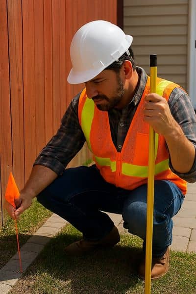
Many renovation problems start with assumptions. Homeowners often trust old fence lines, neighbor conversations, or outdated plats. While these might seem accurate, they can lead to costly surprises.
For example, a family in a Fort Myers community built a retaining wall they thought was on their land. Months later, a neighbor’s survey revealed it was two feet over the line. The wall had to be moved, costing thousands.
Other common issues include:
- Patios or driveways built over easements — which can block utility access in Fort Myers neighborhoods
- Outdoor kitchens or fire pits placed too close to a boundary — risking city code violations
- Landscaping that changes drainage — leading to water pooling on a neighbor’s property, a big concern during Southwest Florida’s rainy season
Each of these situations could have been avoided with a clear boundary survey at the start.
Why a Boundary Survey Helps With Permit Approvals
The City of Fort Myers and Lee County building departments want to see exactly where your structures will be placed. For most renovations, you’ll need a permit, and having a recent boundary survey makes that process smoother. It proves your plans meet setback requirements and respect easements. Without it, you might face delays, redesigns, or outright rejections.
In some cases, a survey can also help you get approvals faster because reviewers don’t have to guess where your property ends. When everything is clear on paper, your renovation moves forward without unnecessary roadblocks.
Boundary Surveys for Popular Fort Myers Projects

Room Additions and Extensions
When you expand your home, even by a few feet, every inch matters. A boundary survey ensures the new footprint stays within legal limits and doesn’t encroach on a neighbor’s property.
Patios, Pools, and Driveways
Outdoor living is a huge part of the Fort Myers lifestyle. But these projects often push right up to property lines. A survey confirms you’re building in the right spot, so you won’t face disputes or demolition orders later.
Fences and Walls
Fences may seem straightforward, but they’re one of the biggest sources of neighbor conflicts in Fort Myers subdivisions. A boundary survey lets you place them exactly where they belong, avoiding future arguments.
The Cost of a Boundary Survey vs. Renovation Delays
Some homeowners hesitate to order a boundary survey because of the cost. But in reality, it’s a fraction of what you might pay if something goes wrong. Moving a fence, tearing down part of a structure, or redesigning plans after construction has started can cost thousands. In comparison, a survey is a small investment that protects your much larger renovation budget.
Think of it like insurance for your project. You spend a little now to avoid spending a lot later.
When to Get a Boundary Survey
The best time to order a boundary survey is before you finalize your renovation plans. By getting the survey early, you give your design and construction teams in Fort Myers the accurate information they need from the start. Even if you had one done years ago, it’s smart to update it especially if nearby properties have been developed or if it’s been more than a decade.
To avoid costly changes once construction begins, make sure you get a property line survey before renovating so your project starts on solid ground.
Integrating the Survey Into Your Renovation Process
Once you receive your survey, share it with your architect, contractor, or engineer. Many professionals can overlay your renovation plans onto the survey map, so everyone works from the same reference point. This keeps the project aligned with both your vision and the legal limits of your property.
Conclusion:
Every renovation begins with a dream. But dreams turn into reality only when the foundation both literal and legal is solid. Starting with a boundary survey means you’ll build in the right place, stay on budget, and avoid neighbor disputes. In a growing city like Fort Myers, where space is valuable and regulations matter, confirming your property lines is the simplest way to protect your investment and enjoy your renovated space without regrets. For expert guidance from a trusted local team, consider professional land surveying services to ensure your renovation starts and finishes without costly surprises.
