How to Find Someone to Survey Your Property Boundary Correctly

There are different reasons why somebody would need boundary surveying in their property. Often, this type of surveying is done if the owner of the property wants to legally place an item on the property such as a new structure or a fence.

A Licensed Land Surveyor

When hiring a land surveyor, you have to make sure that he is duly licensed by your state. A “licensed” land surveyor means he was able to complete his studies, passed all exams and is certified to perform specific types of land surveys.

Hiring a licensed land surveyor is especially important if there is a dispute over a certain area of a property as the court would be asking for the current boundary survey result as well as testimony from a licensed land surveyor. With this being said, you also have to make sure that the surveyor you’re going to hire can also stand as an expert witness in court.

Looking for a Licensed Land Surveyor
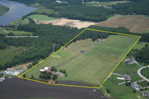
If your property has been surveyed before, it would be easier for you to contact that land surveyor again. This is the best option for several reasons; he already has all information about your property, making it easier for him to perform a new type of survey.

You can typically find your land surveyor’s information on the survey result given to you (if you’ve bought the property from somebody, for instance) or the result given to you by the surveyor himself.

If you don’t have the survey drawing, you can also check the markers put in place by the surveyor during the last survey done on your property. These markers, which looks like iron pegs or pipes, should have the surveyor’s license number/ name on it. You can use this information to find the surveyor online.

If you can’t find the surveyor who worked on your property before, or if the property has never been surveyed, you should easily find a land surveyor in your area (for a land surveyor in the Florida area, click here).

Important Points to Remember when Hiring an ALTA Surveyor

  • As mentioned, make sure that he or she is a licensed land surveyor.
  • He or she should have experience in performing alta boundary surveys. If you’re going to pay somebody, you’d rather have someone who has done it before, right?
  • Look for someone easy to talk to. Communication is very important when hiring a land surveyor. You see, surveying is more of an art than a science – this is why land surveying results vary. It’s important that your surveyor understand why you’re having the survey, what you’re going to use the results for and how soon you’ll be needing the results.
author avatar
Surveyor

More Posts

Stormwater design shown through a curb inlet with sandbags and surface runoff on a residential street during rain preparedness.
civil engineering
Surveyor

Is Your Stormwater Design Ready for the Next Big Rain?

Stormwater design might sound like a background detail until the sky opens up over Pensacola. This week, the National Weather Service in Mobile is warning about heavier rain, coastal flooding, and hazardous surf across Escambia County. The City of Pensacola has also been posting updates about ongoing drainage and stormwater

Read More »
Flooded coastal streets showing rising water along a beachfront walkway.
flood damage
Surveyor

When Streets Flood: Check Your Elevation Certificate

Last week, South Florida feeds lit up with jaw-dropping videos: cars half-submerged on Alton Road, seawater bubbling through storm drains, and joggers wading where sidewalks used to be. The cause wasn’t a storm or a water-main break—it was another round of king tides, the high-tide surges that turn parts of

Read More »
Licensed land surveyor using a total station for a boundary line survey in front of a residential home driveway
boundary surveying
Surveyor

Boundary Line Survey: Fix Flood Insurance on Clipped Lots

If you live in Panama City, you already know flood insurance can feel like a never-ending bill. What makes it worse is when only a corner of your lot is in a FEMA flood zone, yet your lender still demands full flood coverage. Homeowners across Bay County are asking, “How

Read More »
Drone land surveying over a construction site capturing aerial data for mapping and site planning
land surveying
Surveyor

FAA Part 108: What It Means for Drone Land Surveying

Drone land surveying has already changed the way projects get built in Tampa. From construction staking to floodplain mapping, surveyors use drones every day to capture fast and accurate data. Now, the FAA has introduced a new proposal—Part 108—that could reshape how surveyors fly drones, how close they can get

Read More »
Surveyor using total station to measure property survey data near residential homes in a flood zone
boundary surveying
Surveyor

Property Survey Steps to Challenge Your Flood Zone

If you live in Fort Myers, you probably know how expensive flood insurance can be. What many homeowners don’t realize is that their property might not even belong in the flood zone FEMA has mapped. That’s where a property survey comes in. It’s the first and most important step in

Read More »
A car driving through a flooded street with water splashing on both sides, surrounded by green trees and road signs, highlighting the importance of flood elevation surveys for assessing flood risks in residential areas.
flood damage
Surveyor

Homeowners Rush to Get Flood Elevation Surveys

After Hurricane Idalia hit Jacksonville, many homeowners are seeing that Flood Elevation Surveys are more important than ever. These surveys show how high a home sits compared to the surrounding flood areas. In today’s conditions, this information can save time and money on insurance claims. Licensed surveyors are very busy,

Read More »